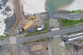
Drone survey and site photography can be used to assess site safety or progress on building or construction sites. Having the full picture of your worksite at every stage of the project is critical for running an efficient construction operation. Propeller empowers onsite teams to capture their own topos, generate cut and fill maps, track project progress against the design, measure volumes, distances, grades and heights at a fraction of the time and cost of traditional ground surveys.